


 Business Technology, Finance Technology & Information Technology
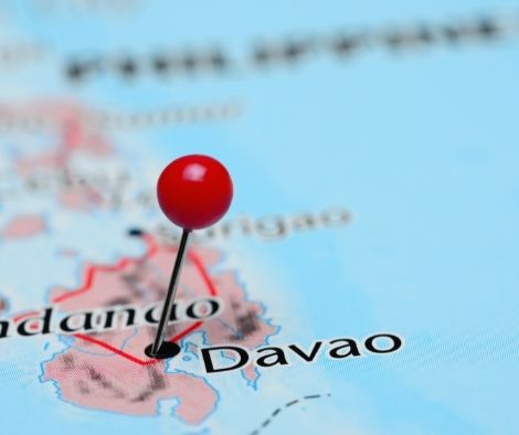
Getting a dredger for flood-prone Davao Norte
The Watermaster is a movable amphibious multipurpose dredger that the government of Davao del Norte purchased with a primary focus on the Libuganon River in Tagum City.
The province is in a crisis after extensive floods this week in six districts caused damage to infrastructure and agriculture totaling PHP50,3 million.
The towns of Asuncion, Kapalong, Santo Tomas, New Corella, Carmen, and Tagum City are among the affected local government units, according to the Davao del Norte Provincial Disaster Risk Reduction and Management Office.
Governor Edwin Jubahib claimed in a Facebook post on Friday that dredging will help stop future calamities.
“In our province, flooding is a recurring issue, so we need to be proactive in reducing its consequences. The Watermaster is an important step towards reaching this objective, according to Jubahib.
Silt, sediment, and other pollutants will be successfully removed from the river by the Watermaster.
“By dredging the rivers, the water flow would be enhanced and flooding would be prevented, “said Jubahib.
With this acquisition, the province will be able to continue its “Oplan Kanal (Channel)” program, which calls for routine desilting of significant rivers.
40 families from Barangay Mabaus in Carmen town recently took part in a flood drill simulation exercise as a part of the Scaling Up Community Resilience (SCORE) Building to Disasters in the Davao Region initiative to improve communities’ capacity to lower the risk of natural disasters.
In order to reduce the loss of lives and property, Senate President Juan Miguel Zubiri encouraged government organizations to identify regions with a high risk of natural disasters and to produce a national hazard map.
Senate Bill No. 1810, also known as the Act Providing for the Issuance of a List of Low-lying Areas of the Philippine Territory Vulnerable to Rising Sea Levels as a Result of Climate Change, was introduced by Zubiri.
The development of a national hazard map, overseen by the Department of Environment and Natural Resources, Department of Science and Technology, and Climate Change Commission, will be an effective first step in examining areas of high risk. According to Zubiri, hazard maps in Japan effectively display the likelihood, magnitude, and location of potential earthquakes.
Effective disaster risk management measures are long overdue for a nation that has lost millions of citizens to earthquakes, floods, and other natural calamities. Given that we are an archipelagic nation in a time of the rapid ecological collapse, this is a particularly pressing concern, he wrote in his explanation.
Save/Share this story with QR CODE
Disclaimer
This article is for informational purposes only and does not constitute endorsement of any specific technologies or methodologies and financial advice or endorsement of any specific products or services.
📩 Need to get in touch?
Feel free to Email Us for comments, suggestions, reviews, or anything else.
We appreciate your reading. 😊Simple Ways To Say Thanks & Support Us:
1.) ❤️GIVE A TIP. Send a small donation thru Paypal😊❤️
Your DONATION will be used to fund and maintain NEXTGENDAY.com
Subscribers in the Philippines can make donations to mobile number 0917 906 3081, thru GCash.
3.) 🛒 BUY or SIGN UP to our AFFILIATE PARTNERS.
4.) 👍 Give this news article a THUMBS UP, and Leave a Comment (at Least Five Words).
AFFILIATE PARTNERS

World Class Nutritional Supplements - Buy Highest Quality Products, Purest Most Healthy Ingredients, Direct to your Door! Up to 90% OFF.
Join LiveGood Today - A company created to satisfy the world's most demanding leaders and entrepreneurs, with the best compensation plan today.

BOC intercepts P228-M of sugar smuggled from Thailand.
On Monday, the Bureau of Customs (BOC) filed two warrants […]

DepEd issues a warning against fraudulent and unlawful solicitation
On Thursday, the Authority of the Undersecretary for Finance at […]

63 million people have been fully vaccinated; 663 thousand children aged 5 to 11 have received their first shot.
MANILA, Philippines — The National Vaccination Operations Center (NVOC) said […]

Devotees of PH’s “first town” observe Sto. Nino Thanksgiving Mass.
On Monday, parishioners of the San Nicolas de Tolentino Shrine […]

The group requests that the SC order Manila Water and Maynilad to reimburse customers.
A request has been made for the Supreme Court (SC) […]

Before the BSP policy rate meeting, TDF rates increased.
The two-week tenor of the Bangko Sentral ng Pilipinas (BSP) […]